
The Badlands to Badlands Trail Initiative is in the process of building a scenic, multi-use trail connecting the rugged landscapes of eastern Montana and western North Dakota. Spanning diverse terrain, the route follows the I-94 corridor, linking the stark beauty of the Terry Badlands with the iconic Badlands of Theodore Roosevelt National Park. The route below starts in Terry, Montana, and ends at the Maah Daah Hey Trail System in North Dakota. See the interactive map here for route features.
Terry > Fallon
Before heading east from Terry, take time to explore local attractions and review the local maps.
Starting at the Terry Pavilion at Four Corners, head east on Old Highway 10-the paved frontage road. It’s narrow with shallow ditches and suitable for bikes, walking, and horseback riding. After roughly 10 miles, you’ll cross the interstate. Continue straight into Fallon or turn east on the CB Route.
Fallon > Glendive
About one mile on CB Route, you’ll reach the Fallon Bridge over the Yellowstone River. As you take a slight right, you can access the Fallon Bridge public fishing access site.
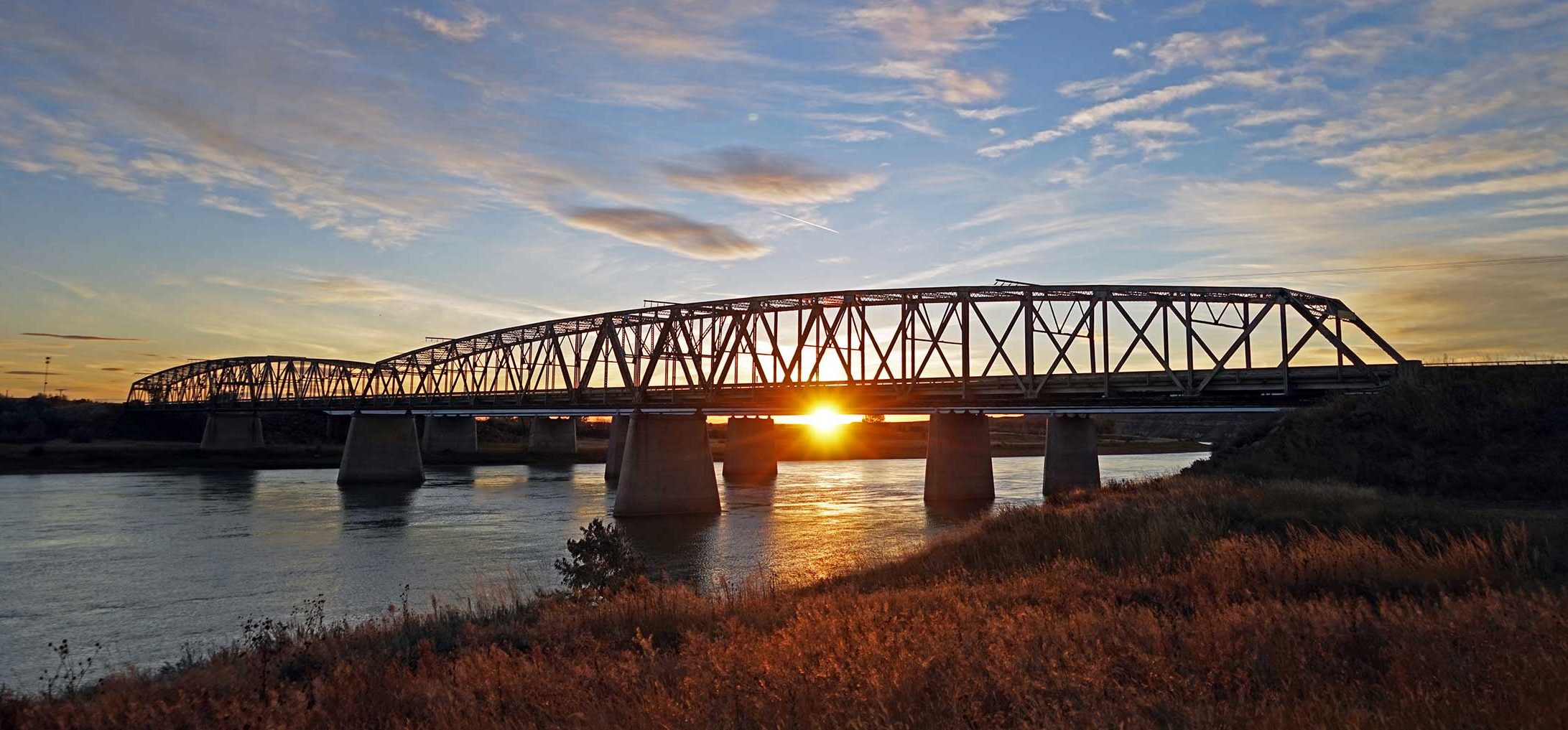 Fallon Bridge Public Fishing Access, Jennifer Nielsen
If you continue on the paved road, you will be surrounded by farmland and badlands. Over the next seven miles, you’ll cross five small creek bridges.
Option: Turning north on Road 235 will lead you to the interstate and Bad Route Rest Area. One cattleguard is located on this stretch of road that is less than a mile. Continue east on Road 261. The paved road turns to gravel with shallow ditches and occasional open-range livestock. This stretch is suitable for horses, bikes, and foot travel. A single bridge appears along this 10‐mile gravel segment.
Option: Take Road 255 north for 2.5 miles to Exit 204 (Whoopup Creek), crossing one small bridge. There are no services at this exit.
If you stay on Road 261 for 10 miles, you will reach the west side of Glendive via West Towne Street. This 10-mile stretch includes eight miles of gravel followed by pavement, with farmland and badlands views.
Once in Glendive, use local maps to navigate to Makoshika State Park, Bell Street Bridge, and town features.
 Makoshika State Park, Nathan Satran Photography
Glendive > Wibaux
Travel north on Merrill Avenue, following Glendive’s bike path system as it carries you up and over the interstate. After crossing the overpass, turn east onto State Street, the frontage road running parallel to I-94. Continue just over a mile. When you reach Bell Prairie Road, turn north. The road begins as pavement before transitioning into wide, well-traveled gravel with varying ditch depths.
Continue for four miles and stay on Road 315. This badlands route may include open-range cattle. Over the next 13.5 miles, conditions remain consistent with two cattleguards. Then continue east on Road 322.
Road 322 provides another six miles of scenic badlands with three more cattleguards, returning you to Interstate 94 at the Griffith Creek exit (Exit 224). The full Bell Prairie route totals just under 20 miles.
Shorter Option: If you prefer a straighter, more direct route instead of the scenic curves of Bell Prairie Road, you can travel from Glendive on the shoulder of Interstate 94. Follow the shoulder for approximately eight miles until you reach the Griffith Creek exit 224.
At Exit 224, connect with Old Highway 10 (Road 106). This paved highway runs 12 miles with narrow shoulders, shallow ditches, and one bridge.
Option: Travel a half‐mile north to the interstate at Hodges Exit 231.
Continue east on Road 106, then turn right onto the gravel connector for one mile before turning left onto Hodges Road. Follow Hodges Road for approximately five miles as it travels through rolling hills on the approach to Wibaux, offering wide prairie views along the way. The full distance from Exit 224 to the town of Wibaux is about 19 miles.
Wibaux > ND State Line
The route travels through Wibaux along Nowlan Avenue, then turns onto Highway 7 (Main Street) as it heads south out of town. After passing under the railroad underpass, riders turn left onto 1st Ave SE toward the baseball field, where the pavement gives way to a gravel truck route. This quiet road leads past the ballfield and along the edge of town for about a half-mile before opening into wide, sweeping prairie.
Option: During the summer months, consider veering a block off Main Street to visit the Wibaux Museum Complex.
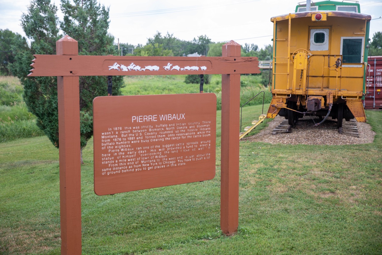 Wibaux Museum Complex, Cassie Solberg
A right turn onto Ponderosa Drive begins a well-graded gravel section with solid ditches and easy grades. The road travels three miles to a high point overlooking Beaver Creek and ends at a T-intersection. Turning left onto Yates Road starts a
long, quiet gravel segment that trends generally southeast. Although the interstate runs nearby, it won’t be visible for the first several miles, giving this portion a wide, uninterrupted prairie feel.
Continue along Yates Road for roughly nine miles, then turn right (south) onto Carlyle Road for one mile. From there, turn left (east) onto Black Diamond Road, which carries the route toward the Montana–North Dakota border along a broad sweeping curve that marks the state transition. Soon after crossing the railroad tracks, the road turns to pavement. This smooth segment provides a simple, direct ride into North Dakota and serves as a welcome break after the longer gravel stretches.
State Line > Beach, North Dakota
The paved Old Highway 10 corridor carries riders two miles into Beach, arriving at a four-way stop. Old 10 continues east out of town, bypassing the downtown core, but riders seeking food or services can turn right onto N Central Avenue for a short, four-block trip into the town center. Reviewing the Beach maps showcases Beach’s local attractions. Staying on Old 10 keeps the route aligned with the main travel corridor heading toward Sentinel Butte.
Beach > Sentinel Butte
East of Beach, the route follows Old Highway 10 for eleven miles of paved riding through classic prairie scenery. The road is lightly traveled and offers broad views of the surrounding landscape. Approaching Sentinel Butte, riders enter a small, quiet
community with limited services. An optional detour before the gas station allows riders to head north across the interstate toward Camel Hump Lake and a connecting trail spur, but the main route continues straight through town.
Sentinel Butte > Medora or Buffalo Gap Approach
Leaving Sentinel Butte, travelers follow Old Highway 10 for another ten miles of paved travel. This section parallels the railroad line and features shallow ditches, narrow shoulders, and open views. The landscape gradually transitions from rolling
prairie toward the broken terrain surrounding Buffalo Gap, marking the approach to the Maah Daah Hey gateway.
Whether you continue on Highway 10 into the historic town of Medora or turn onto Buffalo Gap Road, you’ve reached the gateway to the scenic Maah Daah Hey Trail System and the adventures of western North Dakota. Local maps will guide you to nearby trailheads, overlooks, and points of interest throughout the area.
Turnoff to Buffalo Gap Road
Roughly ten miles east of Sentinel Butte, a left turn onto Buffalo Gap Road begins the rugged final approach to the trailhead. This dirt road is rough and rutted, crossing open range and passing a small rural subdivision near the junction. Roughly a mile before reaching the interstate, a right-hand spur leads to South Buffalo Dam, while the main route continues straight toward the I-94 underpass.
Underpass to Buffalo Gap Trailhead
The route follows Buffalo Gap Road under Interstate 94 and emerges on the north side of the interstate. Here the Buffalo Gap Trailhead and campground lie immediately to the left, marking the official connection point with the Maah Daah Hey system. Continuing straight leads into Buffalo Gap Guest Ranch, which offers lodging, trail access, and connections to additional riding opportunities in the southern Little Missouri grasslands.
END: Buffalo Gap Trailhead / Maah Daah Hey Access