Discover Fall's Hidden Beauty: Scenic Drives in Southeast Montana
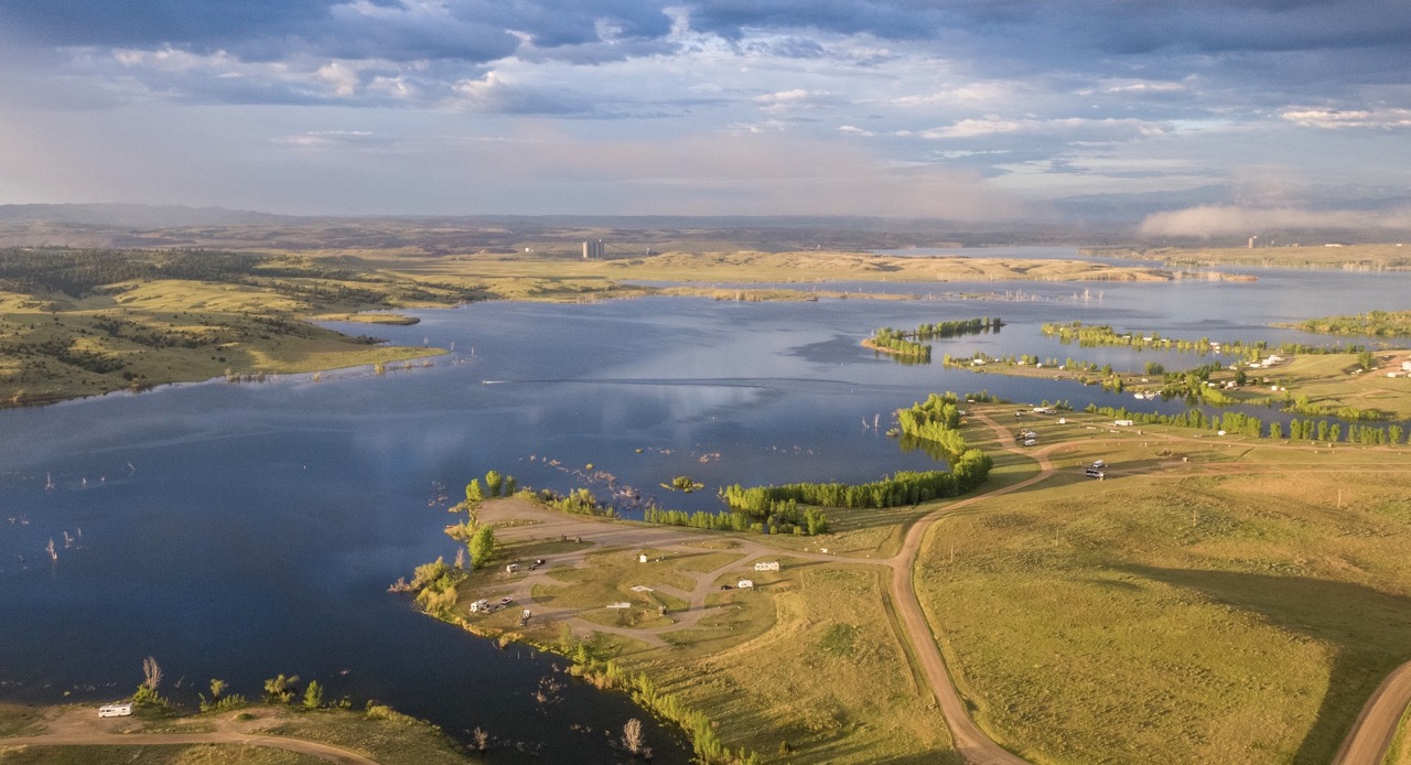
When you think of fall colors, your mind might wander to New England forests or Rocky Mountain vistas. But Southeast Montana holds a secret: a breathtaking autumn landscape that rivals any leaf-peeping destination. Here, the vast prairies, dramatic buttes and winding river valleys transform into a canvas of warm hues that will take your breath away.
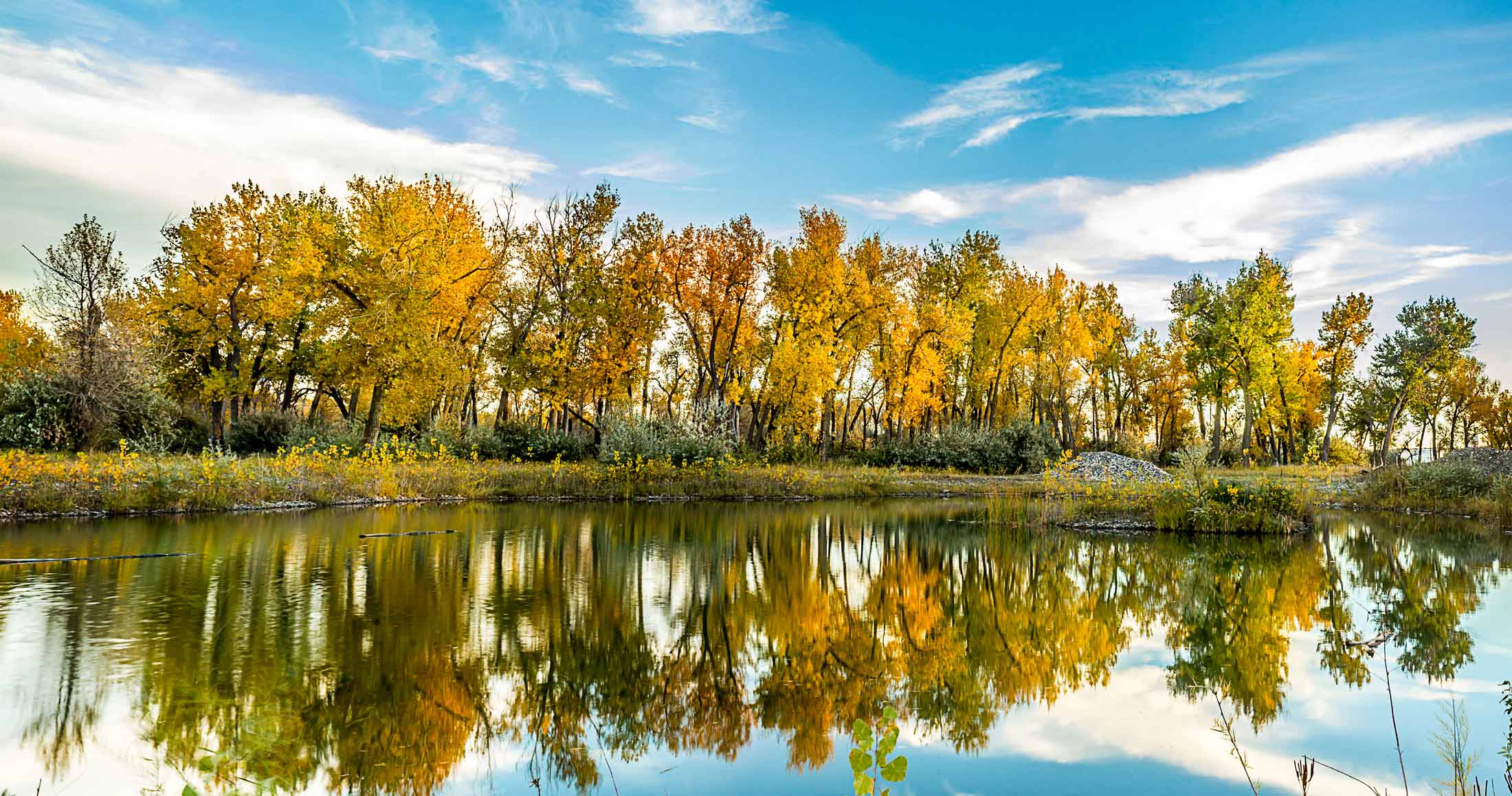
As the air turns crisp and the days grow shorter, Southeast Montana dons its autumn finery. Golden cottonwoods line the riverbanks, their leaves shimmering in the sunlight. The prairie grasses shift from summer green to a rich amber, burgundy and mauve tapestry.
Hop in your car and follow these scenic routes to experience the region's colorful transformation. For the best views and photo opportunities, plan your drives around daybreak or dusk when the low-angled light paints the landscape in its most vibrant hues.
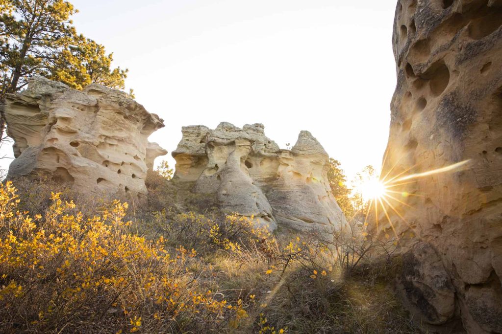
Prairie Paradise Tour
Route: Wibaux to Baker to Ekalaka via Montana Highway 7
Highlights: Rolling prairies, Medicine Rocks State Park, small-town charm
Begin your journey in Wibaux, where the prairies stretch to the horizon. As you cruise south on Highway 7, watch as the landscape unfolds in a patchwork of autumn colors. The grasslands, dotted with scattered trees and shrubs, create a mesmerizing pattern of gold, orange and purple.
Make a stop at Medicine Rocks State Park, where nature's sculptures rise from the prairie. In fall, the weathered sandstone formations contrast beautifully with the changing foliage and crisp blue sky. Take a short hike to admire ancient pictographs and petroglyphs, imagining the stories they've witnessed through countless autumns.
End your day in charming Ekalaka, where small-town hospitality awaits. For a true taste of local flavor, grab some chips and salsa at TSO Cantina – it's a regional favorite that hits the spot after a day of exploration.

**BONUS STOP** If you have a designated driver, sample the seasonal brews at Beaver Creek Brewery in Wibaux. Their harvest wheat beer perfectly captures the essence of fall.
Warrior Trail and Forest Frontiers
Route: "212 Cut-Off" across Crow and Northern Cheyenne Reservations, then east to Ashland
Highlights: Vast prairies, tribal history, Custer Gallatin National Forest
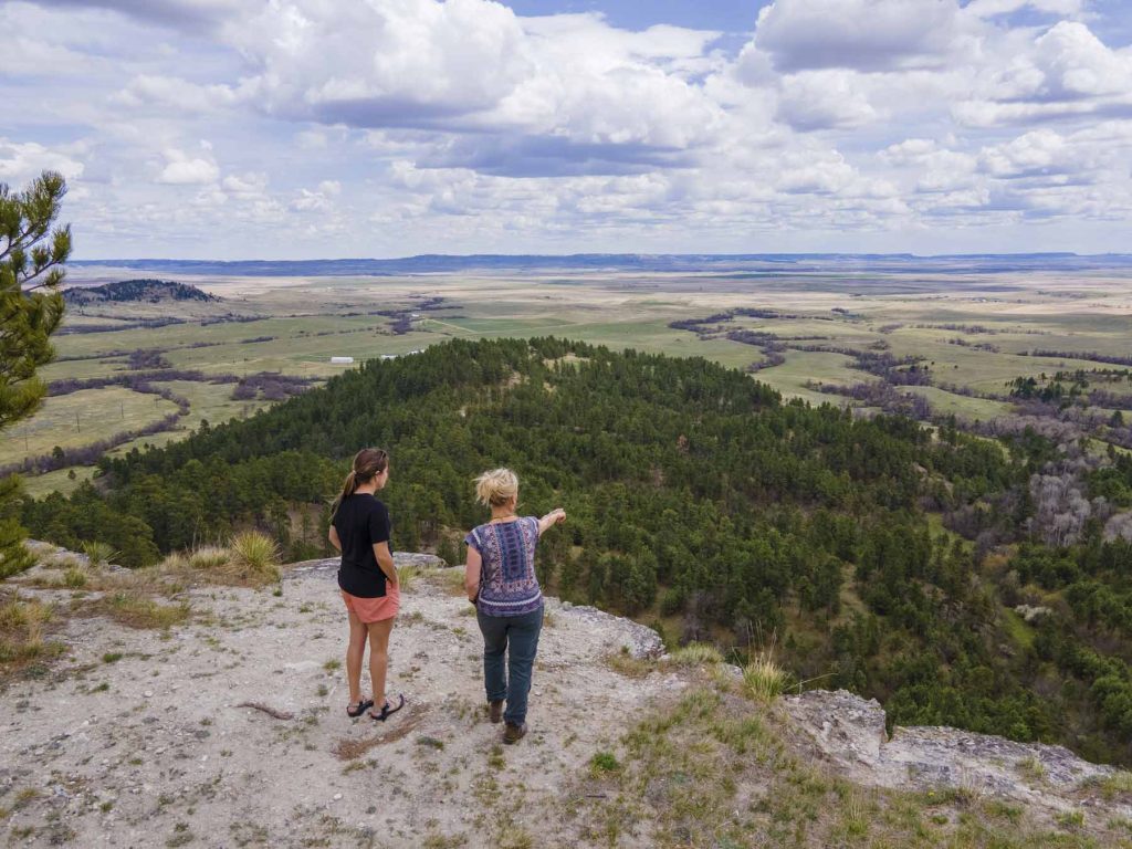
The Warrior Trail Highway, locally known as the "212 Cut-Off," offers a journey through both natural beauty and rich cultural history. As you navigate through the Crow and Northern Cheyenne Indian Reservations, the sweeping prairies come alive with autumn's touch. The golden grasses sway in the breeze, occasionally interrupted by vibrant patches of sumac or cottonwood groves.
Along the way, you'll pass historic battlefields and ancient rock art sites. These reminders of the land's long human history add depth to the scenic drive. As you approach Ashland, prepare for a dramatic change in scenery. The Custer Gallatin National Forest introduces a rugged landscape of pine-covered hills and deep ravines. In autumn, the contrast between the evergreens and the changing deciduous trees creates a stunning patchwork effect. Take advantage of the forest's many scenic pullouts to capture the perfect fall photo.
**PRO TIP** Pick up an Ashland Ranger District map for detailed information on forest recreation areas and hikes that showcase the best fall colors.
Musselshell River Rendezvous
Route: Ryegate to Roundup to Ingomar via Montana Highway 12
Highlights: Musselshell River Valley, small-town festivals, classic Montana vistas
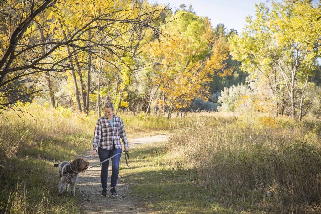
Follow the curves of the Musselshell River on this picturesque drive that captures the essence of Montana's changing seasons. As you travel east from Ryegate, watch as the river valley unfolds, its banks lined with cottonwoods in their autumn glory. The difference between the golden trees and the deep blue Montana sky is simply stunning.
Roundup makes for an ideal midway stop. Stretch your legs along the RiverWalk, where interpretive signs share the area's natural and cultural history.
Continue east to Ingomar, watching as the landscape transitions from river valley to wide-open prairie. This section of the drive showcases the subtle beauty of autumn on the plains – look for the russet tones of bluestem grass and the silver sheen of sagebrush against the golden backdrop.
**SOUVENIR STOP** Browse the unique offerings at Bull Mountain Trading Company in Roundup for a memento of your Montana autumn adventure.
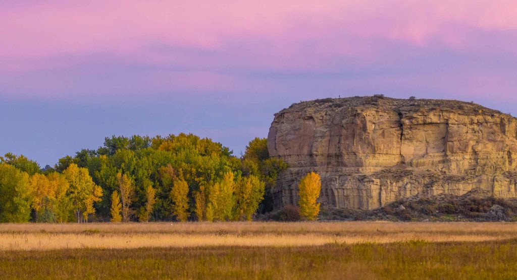
Yellowstone River Ramble
Route: Forsyth to Pompeys Pillar via Old Highway 10 and connecting roads
Highlights: Yellowstone River scenery, historical markers, Pompeys Pillar National Monument
This route combines natural beauty with layers of history, all set against the backdrop of Montana's mightiest river. Begin in Forsyth, following Old Highway 10 as it parallels the Yellowstone River. The golden cottonwoods lining the riverbanks create a stunning contrast with the water and the big Montana sky.
As you travel, keep an eye out for the Trail to the Little Bighorn markers. These 19 roadside stops chronicle the movements of the U.S. 7th Cavalry leading up to the famous battle, adding historical depth to your scenic drive.
Don't miss the chance to cross the Yellowstone on the historic Myers Bridge. On the south side, take a short detour to Howrey Island Recreation Area. Here, a brief walk showcases the river's ecosystem and offers prime opportunities for bird watching – many species pass through during their fall migrations.
End your journey at Pompeys Pillar National Monument. The 202-step climb to the top is well worth the effort, rewarding you with a breathtaking 360-degree view of the Yellowstone Valley in its autumn splendor. Don't forget to look for William Clark's signature, etched into the rock over 200 years ago.

**PHOTO OPP** Time your visit to Pompeys Pillar for late afternoon, when the low sun bathes the surrounding prairies and river valley in a warm, golden light.
Main Gate (May 1st - September 30th): 8:30 AM - 4:30 PM
Interpretive Center (May 1st - September 30th): 9 AM - 4 PM
NOTE: Even when the Monument is closed, visitors may still walk into the site during daylight hours. The walk from the gates to the Pillar is about 3/4 mile. Special arrangements can be made during the off-season for school programs and other special events.
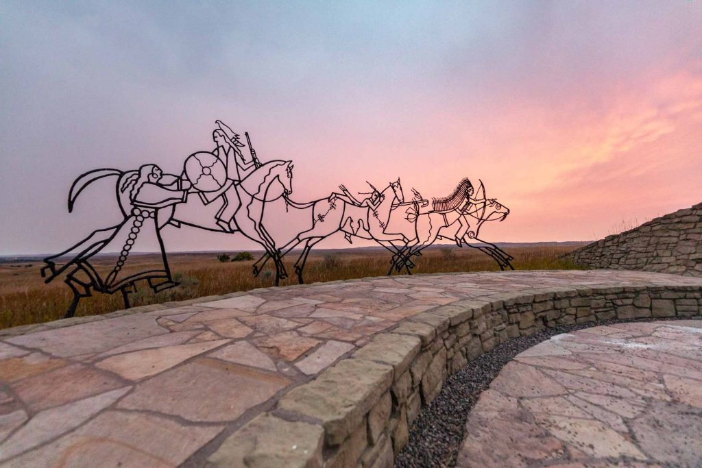
Battlefield Reflections
Route: Little Bighorn Battlefield to Rosebud Battlefield State Park
Highlights: Rolling prairies, mountain views, sites of historical significance
This shorter drive packs a punch when it comes to both scenery and history. Begin at the Little Bighorn Battlefield National Monument, where the 5-mile ridgetop drive offers sweeping views of the surrounding prairies. In autumn, the landscape takes on a warm, golden hue, punctuated by patches of deeper orange and red.
As you drive, let your gaze wander to the horizon, where the Wolf and Bighorn Mountain ranges provide a dramatic backdrop. Their distant peaks, perhaps already dusted with early snow, create a stunning contrast with the warm colors of the prairie.
Continue your historical journey by heading south to Rosebud Battlefield State Park. Here, the "Girl Who Saved Her Brother" battle site offers another perspective on the region's complex past. The park's rolling hills and scattered ponderosa pines showcase a different facet of Montana's fall beauty.

Cap off your tour with a hearty bison burger at Custer Battlefield Trading Post and Café don’t forget to check in on the Burger Trail passport to win prizes. It's the perfect way to refuel while reflecting on the day's sights and stories.
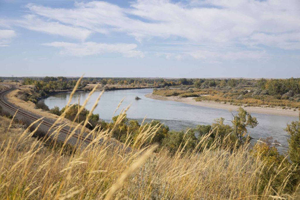
As you explore these scenic routes, remember that Southeast Montana's autumn beauty is subtle yet profound. It's found in the play of light across vast prairies, the rustle of golden leaves along river bottoms and the rich history etched into the land. So, take your time, pull over often and let the magic of fall enchant you.
More from our blog:
